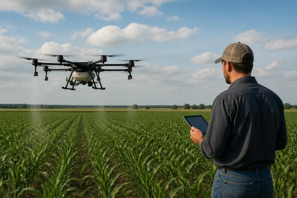
A farming drone can spray a crop, map a field, or check plants from above. The next useful step is making those jobs work together, so a grower gets a clear task instead of another pile of aerial images.
That shift matters because farm work happens under tight limits: changing weather, uneven ground, limited battery time, and small windows for spraying or inspection.
- One flight, several jobs: mapping, crop checks, and targeted treatment can share the same mission.
- Better field decisions: multispectral images can show plant differences that ordinary photos miss.
- More work on the ground: a drone still needs safe charging, clear rules, and a person who can act on its results.
From aerial images to field maps
A camera records what the drone sees. A useful farming system turns those images into a map that marks where plants differ and gives the operator a place to inspect.
Multispectral cameras do this by recording light in several bands. The result can point to changes in plant cover or stress, but the image does not explain the cause by itself.
Dry soil, pests, disease, and damaged plants can look similar from the air.
That is why the next drone needs a clean link between flight data and field work. A map should show the location, date, crop area, and the part of the field that needs a closer check. Without those details, the drone has made a picture rather than a decision.
Spraying needs control, not bigger flight plans
Spraying from the air can place treatment over crops without sending a tractor through wet ground. The hard part is keeping the spray inside the planned area while wind, height, speed, and liquid flow change.
A drone built for this work needs a steady flight path, a measured flow rate, and a clear way to stop the spray. Variable-rate spraying can change the amount of liquid across a field, but it only works when the map and the crop data are accurate enough to guide that change.
The operator also needs to check the rules for the location. Airspace limits, chemical handling, weather conditions, and nearby people can decide whether a flight is safe and legal. A larger tank does not fix those problems.
Autonomy has to survive a real field
Autonomy means the drone can follow a planned route with less direct control from the operator. Positioning from real-time kinematic global navigation satellite systems, known as RTK GNSS, can help the drone hold a precise route when the signal is good.
The field still creates gaps. Trees, wires, buildings, dust, and weak signals can confuse a route. LiDAR or other distance sensors can help the drone detect objects, but sensing a hazard and choosing a safe response are separate jobs.
A farm system also needs a clear handoff. If the drone stops, loses its position, or finds an object in its path, the operator should see the reason and know what action to take. A silent pause wastes the flight window and leaves the crop waiting.
A paused farm drone leaves a practical question: what caused it, and who took control? Reporting at Robot24 can put the flight task, control link, weather, and operator response beside the test result. That record helps a grower judge whether the system can finish work across a real field.
The part many plans leave out
The aircraft is only one piece. The farm also needs batteries, charging points, spare parts, software, trained operators, and a process for checking the data before action.
Battery limits can split one mission into several flights. That adds time for landing, swapping, charging, and restarting the route. A system that works well over a small test plot may need a different plan across a large farm with distant fields.
Data storage creates another practical issue. High-resolution images take space, and weak rural connections can delay uploads. Local processing can reduce the wait, but the farm still needs a way to keep records and compare new flights with older ones.
The unproven part is the full chain from image to result. A drone may spot a patch of stressed plants, yet the farm still needs a person to confirm the cause and choose treatment.
A buying checklist for farm operators
Before choosing a farming drone, check these points in the order your work demands them:
- Name the task: decide if the first job is mapping, inspection, spraying, or a mix.
- Check the payload: confirm the camera, tank, or other equipment fits the drone and leaves room for safe flight.
- Test the route: review trees, wires, buildings, slopes, and areas where GNSS signals may weaken.
- Plan the battery work: count flights, charging time, spare batteries, and the distance between fields.
- Set the data path: decide who reviews images, how maps reach the farm, and where records stay.
- Write the stop rule: set the conditions that end a flight, such as wind, low battery, lost position, or a blocked route.
I'd buy the system that fits one repeatable farm job first, then add cameras or spraying gear after the data and flight process work reliably.
The next farming drone earns its place when it turns a flight into a verified action, with a clear map, a safe route, and a person ready to check the result.